Millisign Tech Guides Drones with Battery-Less Ground Tags

NTT
Autonomous drones often depend on visual cues for precise location, but they face challenges in dark, rainy, or foggy conditions when ground-based lights are unavailable.
This is where the Millisign system, created by researchers from Japan’s NTT Corporation and The University of Tokyo, comes into play. Millisign utilizes oversized RFID (radio frequency identification) tags, similar to those found on various products.
Harnessing Radio Signals for Tag Communication
In a typical RFID system, a battery-less tag is briefly powered by a radio signal emitted from a handheld RFID reader. The tag then employs an integrated antenna to send back a modified signal to the reader, conveying information like product type, manufacturing date, and so on.
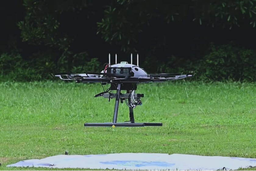
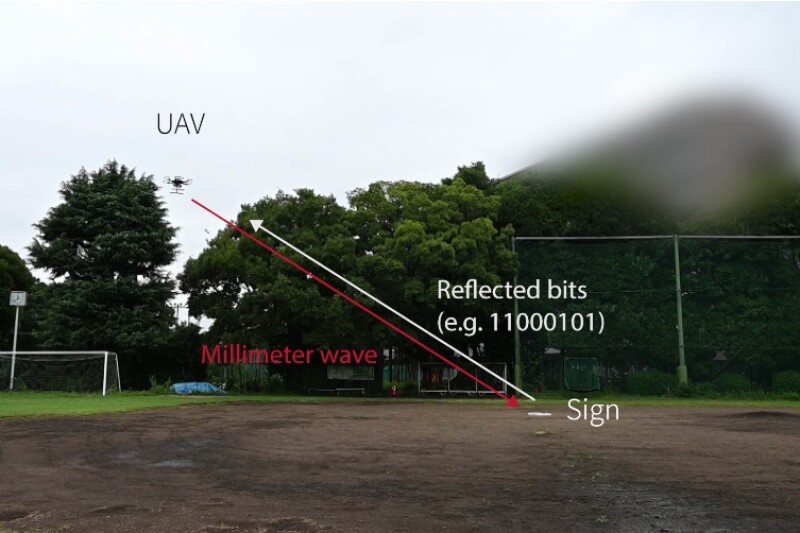
In Millisign, a compact millimeter wave radar unit mounted on a drone replaces the handheld reader. When one of the large tags on a landing pad receives a radio signal from this unit, it sends a response signal to the drone.
This response indicates the tag or pad’s location in relation to the drone, enabling the aircraft to find it even when not in direct sight. The strength of the received signal determines the proximity of the drone to its target.

NTT
Crucially, Millisign tags include corner reflectors that enable them to transmit and receive signals across a broad three-dimensional angle. In the present iteration of the system, a 292 x 600-mm (11.5 x 23.6-in) tag can be detected by an airborne drone from a range of 10 to 15 meters (33 to 49 ft). In contrast, conventional RFID tags, using a flat antenna, have a significantly shorter and narrower range.
However, with all these advantages in mind, one might wonder why drones couldn’t simply rely on GPS instead.
High Costs and Complex Infrastructure
“When contemplating a landing situation that relies on GPS, acquiring relative positions mandates the use of two GPS modules on a UAV (unmanned aerial vehicle) and a landing port, along with a communication channel connecting them. This leads to substantial installation and maintenance expenses,” explained NTT research engineer Tatsuya Iizuka.
Conversely, our system merely necessitates the installation of a battery-less tag at the landing ports, which is a cost-effective solution for various UAV missions conducted in areas with high access costs, like urban high-rise buildings, coastal and mountainous regions.”
For more information about the Millisign system, please refer to the accompanying video.
Read the original article on: New Atlas
Read more: The US Military Plans to Use Thousands of Autonomous Combat Drones Against China


